|
| |||||
Image:1883 Map.jpg
From Brooklyn Centre Wiki
(Difference between revisions)
Size of this preview: 800 × 503 pixels
Full resolution (2600 × 1636 pixel, file size: 429 KB, MIME type: image/jpeg)
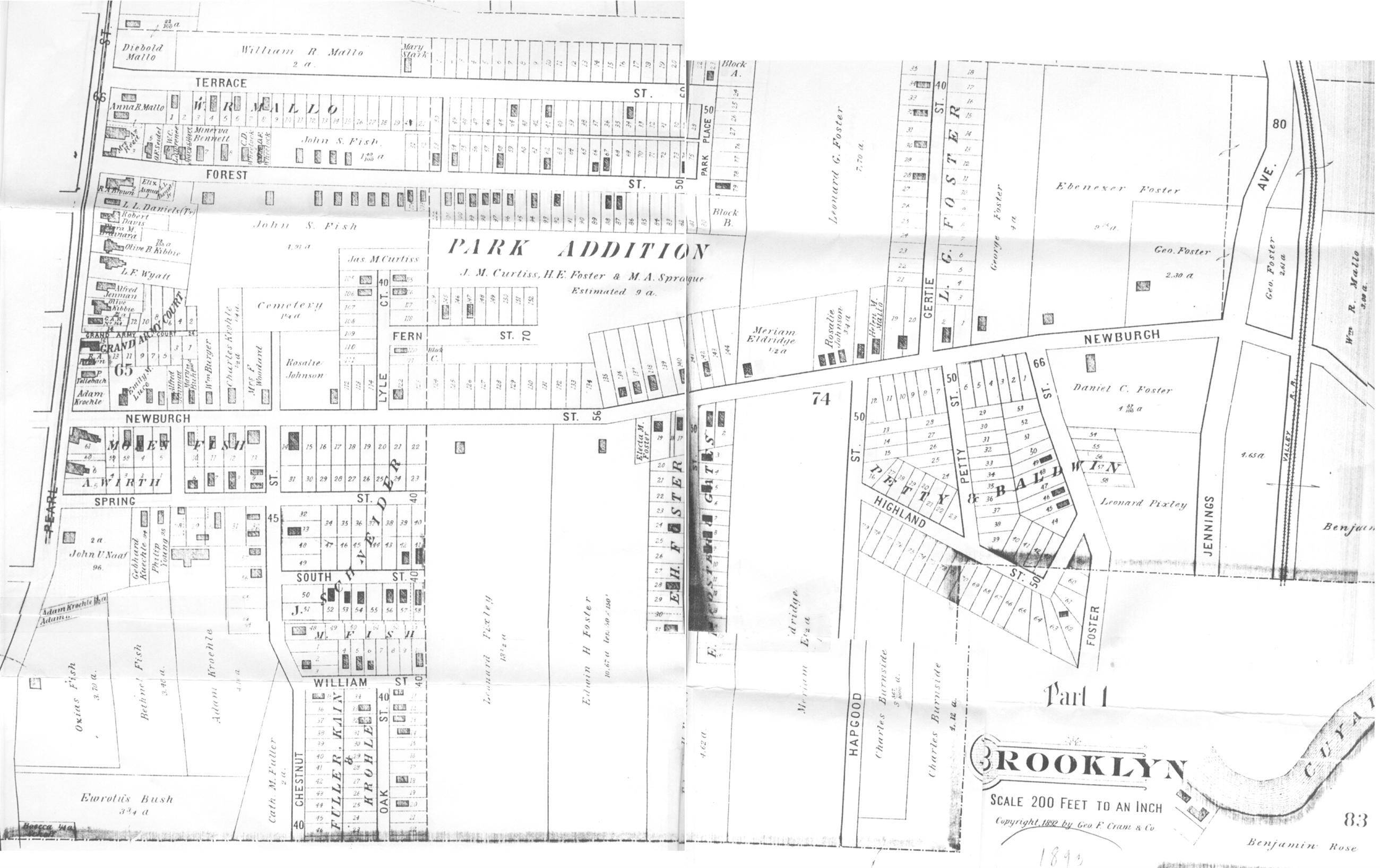
(1883 map of Brooklyn Centre showing property owners along Newburgh Street (modern day Denison Avenue).) |
(1883 map of Brooklyn Centre showing property owners along Newburgh Street (modern day Denison Avenue).) |
Current revision
1883 map of Brooklyn Centre showing property owners along Newburgh Street (modern day Denison Avenue).
File history
Click on a date/time to view the file as it appeared at that time.
| Date/Time | User | Dimensions | File size | Comment | |
|---|---|---|---|---|---|
| (current) | 00:23, 17 January 2007 | Sandy (Talk | contribs) | 2600×1636 | 429 KB | 1883 map of Brooklyn Centre showing property owners along Newburgh Street (modern day Denison Avenue). |
- Edit this file using an external application
See the setup instructions for more information.
Links
The following pages link to this file:
