|
| |||||
Image:Sawtell, Benjamin property.JPG
From Brooklyn Centre Wiki
(Difference between revisions)
No higher resolution available.
Sawtell,_Benjamin_property.JPG (790 × 390 pixel, file size: 76 KB, MIME type: image/jpeg)
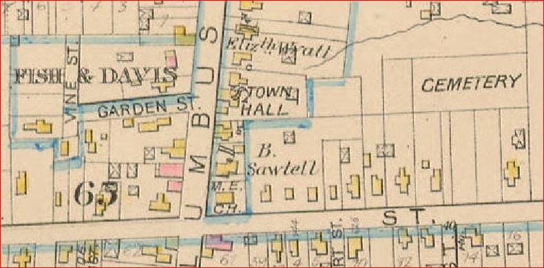
(1881 Atlas showing location of Benjamin Sawtell's property on Newburgh St. (now Denison Ave.)) |
(1881 Atlas showing location of Benjamin Sawtell's property on Newburgh St. (now Denison Ave.)) |
Current revision
1881 Atlas showing location of Benjamin Sawtell's property on Newburgh St. (now Denison Ave.)
File history
Click on a date/time to view the file as it appeared at that time.
| Date/Time | User | Dimensions | File size | Comment | |
|---|---|---|---|---|---|
| (current) | 15:10, 19 February 2012 | Sandy (Talk | contribs) | 790×390 | 76 KB | 1881 Atlas showing location of Benjamin Sawtell's property on Newburgh St. (now Denison Ave.) |
- Edit this file using an external application
See the setup instructions for more information.
Links
The following pages link to this file:
Metadata
This file contains additional information, probably added from the digital camera or scanner used to create or digitize it. If the file has been modified from its original state, some details may not fully reflect the modified image.
| Date and time of data generation | 10:10, 19 February 2012 |
|---|---|
| Author | Sandy |
| Date and time of digitizing | 10:10, 19 February 2012 |
| DateTimeOriginal subseconds | 47 |
| DateTimeDigitized subseconds | 47 |
