|
| |||||
Neighborhood Photo Album
From Brooklyn Centre Wiki
| Line 6: | Line 6: | ||
Image:Redman-lowerNortheastside.jpg|Redman Ave. - northside from W14th to W13th | Image:Redman-lowerNortheastside.jpg|Redman Ave. - northside from W14th to W13th | ||
Image:Redman-lowerSoutheastside.jpg|Redman Ave. - southside from W14th to W13th | Image:Redman-lowerSoutheastside.jpg|Redman Ave. - southside from W14th to W13th | ||
| - | Image:Alley.jpg|Foster Ct. - Alley between | + | Image:Alley.jpg|Foster Ct. - Alley between W.13th & W.14th looking north |
Image:Alley_overhead_(Small).jpg|Foster Ct. - western end of the alley looking southeast | Image:Alley_overhead_(Small).jpg|Foster Ct. - western end of the alley looking southeast | ||
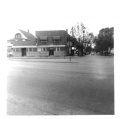
| - | Image:West14th-lookingNorth.jpg|West 14th | + | Image:West14th-lookingNorth.jpg|West 14th St. and Denison looking north<br>The vantage point is from the old Gulf Gas Station. [[Gasior's Bar]] is on the left corner. To the left of Gasior's can be seen a white house that was the home of [[George Foster]], son of the original settler / landowner [[Ebenezer Foster]] of this side of Denison Ave. |
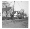
| - | Image:West14th-lookingNorth2.jpg|West 14th | + | Image:West14th-lookingNorth2.jpg|West 14th St. and Denison looking north<br>The vantage point is about 3 houses from the corner of Denison and 14th. The brown house in the distance was on Redman Ave. |
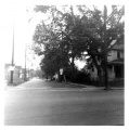
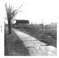
| - | Image:West14th-lookingSouth-before.jpg|West 14th | + | Image:West14th-lookingSouth-before.jpg|West 14th St. looking south from Redman Ave. towards Denison Ave. (Before the [[Jennings Freeway]].) |
| + | Image:West15th-lookingNorth.jpg|West 15th St. looking north from Denison Ave. | ||
</gallery> | </gallery> | ||
| - | === | + | |
| + | ===Denison Ave., Jennings Ave.=== | ||
<gallery> | <gallery> | ||
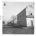
| + | Image:Denison_and_W14th_looking_west.gif|Denison Ave. and West 14th looking west.<br>-- On the right is the bakery that was operated as early as 1936 by Stanley Mankowski and then for a short time in 1942 by Frank Samosky (brother of the Samosky who ran the bakery near Fleet Ave.) and later by Frank Staszewski from 1942 into the mid-1950's. He died in 1957.<br>-- On the left, labeled as 1409 Denison is the large block building that was owned by John and Mary Oprzadek.<br>-- ''(City Hall Photograph Collection at the Cleveland Public Library)'' | ||
Image:Denison_Hill.jpg|Denison Ave. hill down to Jennings Ave. | Image:Denison_Hill.jpg|Denison Ave. hill down to Jennings Ave. | ||
</gallery> | </gallery> | ||
| + | |||
| + | |||
| + | ===Jennings Freeway Demolition=== | ||
| + | |||
| + | <gallery> | ||
| + | Image:Freeway4x.jpg|'''West 14th St.''' looking south from Redman. The State shows no mercy for the condemned neighborhood. This view taken in 1964 shows part of the houses already torn down for the Jennings Freeway. | ||
| + | Image:West14th-lookingSouth-after.jpg|'''West 14th St.''' looking south from Redman. This view taken in 1964 shows the same area after it was cleaned up a bit. | ||
| + | Image:Freeway1x.jpg|'''West 15th St.''' and Redman looking west. Demolition has started. Watch the small house on the left. Next picture shows what happens. | ||
| + | Image:Freeway2x.jpg|'''West 15th St.''' and Redman looking west. Breaking thru... | ||
| + | Image:Freeway3x.jpg|'''West 15th St.''' and Redman looking west. CRASH!!!! | ||
| + | Image:1230Redman-after.jpg|'''1230 Redman Ave.''' A shell of it's former self. | ||
| + | Image:1302Redman-after.jpg|'''1302 Redman Ave.''' | ||
| + | Image:1314Redman-after.jpg|'''1314 Redman Ave.''' Also a shell of it's former self. | ||
| + | Image:Freeway5x.jpg|'''Denison Ave.''' looking east. The vantage point is the East Denison playground sidewalk that led into the open lot on the corner of W.15th and Denison. You are looking out across what used to be Kilroy's house, the bakery, and [[Gasior's Bar]]. All gone now. The building just left of center is [[Slabe's Shoe Store]] with the [[Harvard-Denison Bridge]] just right of that. | ||
| + | |||
| + | </gallery> | ||
| + | |||
===West 25th St.=== | ===West 25th St.=== | ||
| Line 24: | Line 44: | ||
Image: | Image: | ||
</gallery> | </gallery> | ||
| + | |||
===Miscellaneous=== | ===Miscellaneous=== | ||
Revision as of 19:52, 6 April 2007
Contents |
West 13th, West 14th, West 15th, and Redman
West 14th St. and Denison looking north |
|||
West 14th St. looking south from Redman Ave. towards Denison Ave. (Before the Jennings Freeway.) |
Denison Ave., Jennings Ave.
Denison Ave. and West 14th looking west. |
Jennings Freeway Demolition
Denison Ave. looking east. The vantage point is the East Denison playground sidewalk that led into the open lot on the corner of W.15th and Denison. You are looking out across what used to be Kilroy's house, the bakery, and Gasior's Bar. All gone now. The building just left of center is Slabe's Shoe Store with the Harvard-Denison Bridge just right of that. |
West 25th St.


