|
| |||||
Neighborhood Photo Album
From Brooklyn Centre Wiki
(→Denison Ave., Jennings Ave.) |
(→City Dump and Redman Woods) |
||
| Line 17: | Line 17: | ||
===City Dump and Redman Woods=== | ===City Dump and Redman Woods=== | ||
<gallery> | <gallery> | ||
| - | Image:City_Dump_north_of_Denison_-_facing_north.jpg|'''City Dump''' - Facing north (just north of Denison Ave. and west of West 15th) | + | Image:City_Dump_north_of_Denison_-_facing_north.jpg|'''City Dump''' - Facing north (just north of Denison Ave. and west of West 15th) The rubbish that was dumped here served as a landfill. Originally, there was a deep ravine between [[Riverside Cemetery]] and the property on [[Gertie St.|West 15th Street]] |
Image:City_Dump_north_of_Denison_-_facing_northwest.jpg|'''City Dump''' - Facing northwest (City Hospital) (just north of Denison Ave. and west of West 15th) | Image:City_Dump_north_of_Denison_-_facing_northwest.jpg|'''City Dump''' - Facing northwest (City Hospital) (just north of Denison Ave. and west of West 15th) | ||
Image:Woods_behind_Redman_-_facing_east.jpg|'''Redman Woods''' - Facing east. The woods were between Jennings Ave. and Redman Ave. and belonged to [[Riverside Cemetery]] | Image:Woods_behind_Redman_-_facing_east.jpg|'''Redman Woods''' - Facing east. The woods were between Jennings Ave. and Redman Ave. and belonged to [[Riverside Cemetery]] | ||
Revision as of 19:46, 26 November 2007
Contents |
West 13th, West 14th, West 15th, and Redman
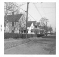
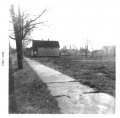
West 14th St. and Denison looking north |
|||
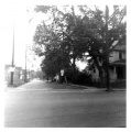
West 14th St. looking south from Redman Ave. towards Denison Ave. (Before the Jennings Freeway.) |
City Dump and Redman Woods
City Dump - Facing north (just north of Denison Ave. and west of West 15th) The rubbish that was dumped here served as a landfill. Originally, there was a deep ravine between Riverside Cemetery and the property on West 15th Street |
Redman Woods - Facing east. The woods were between Jennings Ave. and Redman Ave. and belonged to Riverside Cemetery |
Redman Woods - Facing south. The woods were between Jennings Ave. and Redman Ave. and belonged to Riverside Cemetery |
|
Redman Woods - Mystery wall. This odd stone wall was on the northern part of the Redman woods. We never have been able to figure out why. Riverside Cemetery was probably planning to span the ravine with a bridge to allow vehicle traffic from one side to the other. |
Denison Ave., Jennings Ave.
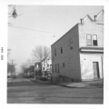
Denison Ave. and West 14th looking west. |
Jennings Freeway Demolition
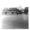
Denison Ave. looking east. The vantage point is the East Denison playground sidewalk that led into the open lot on the corner of W.15th and Denison. You are looking out across what used to be Kilroy's house, the bakery, and Gasior's Bar. All gone now. The building just left of center is Slabe's Shoe Store with the Harvard-Denison Bridge just right of that. |
West 25th St.
- Photos wanted! Please submit any you might have for the Brooklyn Centre area
Miscellaneous
- Photos wanted! Please submit any you might have for the Brooklyn Centre area


