|
| |||||
Neighborhood Photo Album
From Brooklyn Centre Wiki
(→West 13th, West 14th, West 15th, and Redman) |
|||
| Line 28: | Line 28: | ||
<gallery> | <gallery> | ||
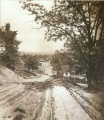
| - | Image: | + | Image:Could_be_denison_hill.jpg|How Denison hill would have looked in the 1800's. |
Image:Denison_Hill.jpg|'''Denison Ave.''' hill down to Jennings Ave. Note the long wooden stairway that helped pedestrians get from the top of the hill to the bottom. | Image:Denison_Hill.jpg|'''Denison Ave.''' hill down to Jennings Ave. Note the long wooden stairway that helped pedestrians get from the top of the hill to the bottom. | ||
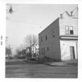
| + | Image:Denison_and_W14th_looking_west.gif|'''Denison Ave. and West 14th''' looking west.<br>-- On the right is the bakery that was operated as early as 1936 by Stanley Mankowski and then for a short time in 1942 by Frank Samosky (brother of the Samosky who ran the bakery near Fleet Ave.) and later by Frank Staszewski from 1942 into the mid-1950's. He died in 1957.<br>-- On the left, labeled as 1409 Denison is the large block building that was owned by John and Mary Oprzadek.<br>-- ''(City Hall Photograph Collection at the Cleveland Public Library)'' | ||
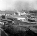
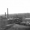
Image:BeltLineRoad.jpg|'''Belt Line Rd.''' showing some of the factories that were present around 1960. In the decades preceeding, many of the Polish immigrants of the neighborhood worked in the tanning mills or soap works that existed there back then. | Image:BeltLineRoad.jpg|'''Belt Line Rd.''' showing some of the factories that were present around 1960. In the decades preceeding, many of the Polish immigrants of the neighborhood worked in the tanning mills or soap works that existed there back then. | ||
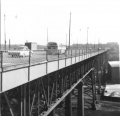
Image:BeltLineRoad2.jpg|'''Belt Line Rd.''' looking north (taken from the Harvard-Denison Bridge) | Image:BeltLineRoad2.jpg|'''Belt Line Rd.''' looking north (taken from the Harvard-Denison Bridge) | ||
Image:Factories.jpg|'''Factories''' in the Jennings and Denison Aves. area. | Image:Factories.jpg|'''Factories''' in the Jennings and Denison Aves. area. | ||
| + | </gallery> | ||
| + | |||
| + | ===Harvard-Denison Bridge=== | ||
| + | <gallery> | ||
| + | Image:Harvard-Denison bridge early image.jpg | ||
| + | Image:Harvard-Denison_Bridge_plaque.jpg|Dedication plaque | ||
| + | Image:Harvard-Denison_Bridge_1964.jpg|Looking east (circa 1964) | ||
| + | Image:Harvard-Denison_Bridge_stairway.jpg|Stairway that led from the bridge deck down to Jennings Avenue | ||
| + | Image:Harvard-Denison_Bridge_with_CTS_bus.jpg|Looking east - #18 CTS Bus | ||
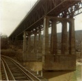
| + | Image:Under_the_Harvard-Denison_bridge.jpg|Under the Harvard-Denison Bridge (about 1964) | ||
| + | Image:Harvard-Denison_bridge_3.jpg|Concrete supports - east end over the Cuyahoga (circa 1964) | ||
| + | |||
</gallery> | </gallery> | ||
Revision as of 16:55, 30 November 2007
Contents |
West 13th, West 14th, West 15th, and Redman
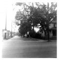
West 14th St. and Denison looking north |
|||
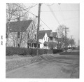
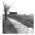
West 14th St. looking south from Redman Ave. towards Denison Ave. (Before the Jennings Freeway.) |
West 14th St. looking south from Redman Ave. towards Denison Ave. (Before the Jennings Freeway.) |
City Dump and Redman Woods
City Dump - Facing north (just north of Denison Ave. and west of West 15th) The rubbish that was dumped here served as a landfill. Originally, there was a deep ravine between Riverside Cemetery and the property on West 15th Street |
Redman Woods - Facing east. The woods were between Jennings Ave. and Redman Ave. and belonged to Riverside Cemetery |
Redman Woods - Facing south. The woods were between Jennings Ave. and Redman Ave. and belonged to Riverside Cemetery |
|
Redman Woods - Mystery wall. This odd stone wall was on the northern part of the Redman woods. We never have been able to figure out why. Riverside Cemetery was probably planning to span the ravine with a bridge to allow vehicle traffic from one side to the other. |
Denison Ave., Jennings Ave.
Denison Ave. and West 14th looking west. |
|||
Harvard-Denison Bridge
Jennings Freeway Demolition
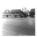
Denison Ave. looking east. The vantage point is the East Denison playground sidewalk that led into the open lot on the corner of W.15th and Denison. You are looking out across what used to be Kilroy's house, the bakery, and Gasior's Bar. All gone now. The building just left of center is Slabe's Shoe Store with the Harvard-Denison Bridge just right of that. |
West 25th St.
- Photos wanted! Please submit any you might have for the Brooklyn Centre area
Miscellaneous
- Photos wanted! Please submit any you might have for the Brooklyn Centre area


