|
| |||||
Neighborhood Photo Album
From Brooklyn Centre Wiki
(→Denison Ave., Jennings Ave.) |
(→West 25th St.) |
||
| (24 intermediate revisions not shown.) | |||
| Line 1: | Line 1: | ||
===West 13th, West 14th, West 15th, and Redman=== | ===West 13th, West 14th, West 15th, and Redman=== | ||
| - | <gallery> | + | <gallery perrow="5"> |
Image:1949_Aerial_View_of_Barbarowa_neighborhood.jpg|1949 Aerial view of the Barbarowa Neighborhood | Image:1949_Aerial_View_of_Barbarowa_neighborhood.jpg|1949 Aerial view of the Barbarowa Neighborhood | ||
Image:West13th.jpg|'''West 13th St.''' - Looking south from Redman [About 1960] | Image:West13th.jpg|'''West 13th St.''' - Looking south from Redman [About 1960] | ||
Image:3701_W13th_-_Tillie_Kuczek_store.jpg|'''West 13th St.''' - Tillie Kuczek's store at 3701 W13th | Image:3701_W13th_-_Tillie_Kuczek_store.jpg|'''West 13th St.''' - Tillie Kuczek's store at 3701 W13th | ||
| + | Image:1222_Redman_house.jpg|'''1222 Redman Ave.''' - Bartkiewicz home<br><small>(submitted by the Bartkiewicz family)</small> | ||
Image:Redman-lowerNortheastside.jpg|'''Redman Ave.''' - northside from W14th to W13th | Image:Redman-lowerNortheastside.jpg|'''Redman Ave.''' - northside from W14th to W13th | ||
Image:Redman-lowerSoutheastside.jpg|'''Redman Ave.''' - southside from W14th to W13th | Image:Redman-lowerSoutheastside.jpg|'''Redman Ave.''' - southside from W14th to W13th | ||
| Line 11: | Line 12: | ||
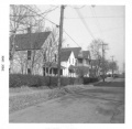
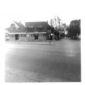
Image:West14th-lookingNorth.jpg|'''West 14th St.''' and Denison looking north<br>The vantage point is from the old Gulf Gas Station. [[Gasior's Bar]] is on the left corner. To the left of Gasior's can be seen a white house that was the home of [[George Foster]], son of the original settler / landowner [[Ebenezer Foster]] of this side of Denison Ave. | Image:West14th-lookingNorth.jpg|'''West 14th St.''' and Denison looking north<br>The vantage point is from the old Gulf Gas Station. [[Gasior's Bar]] is on the left corner. To the left of Gasior's can be seen a white house that was the home of [[George Foster]], son of the original settler / landowner [[Ebenezer Foster]] of this side of Denison Ave. | ||
Image:West14th-lookingNorth2.jpg|'''West 14th St.''' and Denison looking north<br>The vantage point is about 3 houses from the corner of Denison and 14th. The brown house in the distance was on Redman Ave. | Image:West14th-lookingNorth2.jpg|'''West 14th St.''' and Denison looking north<br>The vantage point is about 3 houses from the corner of Denison and 14th. The brown house in the distance was on Redman Ave. | ||
| + | Image:West14th-lookingSouth.jpg|'''West 14th St.''' looking south from Redman Ave. towards Denison Ave. (Before the [[Jennings Freeway]].) | ||
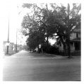
Image:West14th-lookingSouth-before.jpg|'''West 14th St.''' looking south from Redman Ave. towards Denison Ave. (Before the [[Jennings Freeway]].) | Image:West14th-lookingSouth-before.jpg|'''West 14th St.''' looking south from Redman Ave. towards Denison Ave. (Before the [[Jennings Freeway]].) | ||
| - | Image:West15th-lookingNorth.jpg|'''West 15th St.''' looking north from Denison Ave. | + | Image:West15th-lookingNorth.jpg|'''West 15th St.''' looking north from Denison Ave. The house on the right is the '''Kilroy''' home. |
</gallery> | </gallery> | ||
===City Dump and Redman Woods=== | ===City Dump and Redman Woods=== | ||
| - | <gallery> | + | |
| + | <gallery perrow="5"> | ||
Image:City_Dump_north_of_Denison_-_facing_north.jpg|'''City Dump''' - Facing north (just north of Denison Ave. and west of West 15th) The rubbish that was dumped here served as a landfill. Originally, there was a deep ravine between [[Riverside Cemetery]] and the property on [[Gertie St.|West 15th Street]] | Image:City_Dump_north_of_Denison_-_facing_north.jpg|'''City Dump''' - Facing north (just north of Denison Ave. and west of West 15th) The rubbish that was dumped here served as a landfill. Originally, there was a deep ravine between [[Riverside Cemetery]] and the property on [[Gertie St.|West 15th Street]] | ||
Image:City_Dump_north_of_Denison_-_facing_northwest.jpg|'''City Dump''' - Facing northwest (City Hospital) (just north of Denison Ave. and west of West 15th) | Image:City_Dump_north_of_Denison_-_facing_northwest.jpg|'''City Dump''' - Facing northwest (City Hospital) (just north of Denison Ave. and west of West 15th) | ||
| Line 23: | Line 26: | ||
Image:Mystery_wall.jpg|'''Redman Woods''' - Mystery wall. This odd stone wall was on the northern part of the Redman woods. We never have been able to figure out why. [[Riverside Cemetery]] was probably planning to span the ravine with a bridge to allow vehicle traffic from one side to the other. | Image:Mystery_wall.jpg|'''Redman Woods''' - Mystery wall. This odd stone wall was on the northern part of the Redman woods. We never have been able to figure out why. [[Riverside Cemetery]] was probably planning to span the ravine with a bridge to allow vehicle traffic from one side to the other. | ||
</gallery> | </gallery> | ||
| + | |||
===Denison Ave., Jennings Ave.=== | ===Denison Ave., Jennings Ave.=== | ||
| - | <gallery> | + | <gallery perrow="5"> |
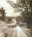
| - | Image: | + | Image:Could_be_denison_hill.jpg|How '''Denison hill''' would have looked in the 1800's. This image isn't really Denison hill. The view was actually from Zanesville, but the resemblance was so strong, that it helps give you an idea of what might have been. |
Image:Denison_Hill.jpg|'''Denison Ave.''' hill down to Jennings Ave. Note the long wooden stairway that helped pedestrians get from the top of the hill to the bottom. | Image:Denison_Hill.jpg|'''Denison Ave.''' hill down to Jennings Ave. Note the long wooden stairway that helped pedestrians get from the top of the hill to the bottom. | ||
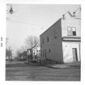
| + | Image:Denison_and_W14th_looking_west.gif|'''Denison Ave. and West 14th''' looking west.<br>-- On the right is the bakery that was operated as early as 1936 by Stanley Mankowski and then for a short time in 1942 by Frank Samosky (brother of the Samosky who ran the bakery near Fleet Ave.) and later by Frank Staszewski from 1942 into the mid-1950's. He died in 1957.<br>-- On the left, labeled as 1409 Denison is the large block building that was owned by John and Mary Oprzadek.<br>-- ''(City Hall Photograph Collection at the Cleveland Public Library)'' | ||
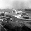
Image:BeltLineRoad.jpg|'''Belt Line Rd.''' showing some of the factories that were present around 1960. In the decades preceeding, many of the Polish immigrants of the neighborhood worked in the tanning mills or soap works that existed there back then. | Image:BeltLineRoad.jpg|'''Belt Line Rd.''' showing some of the factories that were present around 1960. In the decades preceeding, many of the Polish immigrants of the neighborhood worked in the tanning mills or soap works that existed there back then. | ||
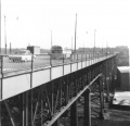
Image:BeltLineRoad2.jpg|'''Belt Line Rd.''' looking north (taken from the Harvard-Denison Bridge) | Image:BeltLineRoad2.jpg|'''Belt Line Rd.''' looking north (taken from the Harvard-Denison Bridge) | ||
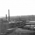
| - | Image:Factories.jpg|'''Factories''' in the Jennings and Denison Aves. area. | + | Image:Factories.jpg|'''Factories''' in the Jennings and Denison Aves. area. The tall smoke stacks are probably part of [[Harshaw Chemical]]. |
| + | </gallery> | ||
| + | |||
| + | |||
| + | ===Harvard-Denison Bridge=== | ||
| + | <gallery perrow="5"> | ||
| + | Image:Harvard-Denison bridge early image.jpg|Early photo of the Harvard-Denison bridge. Probably taken around 1910. Note the absence of factories. The view is to the northeast. The stairs down to Jennings Avenue can be seen a little more than halfway down the bridge. | ||
| + | Image:Harvard-Denison_Bridge_plaque.jpg|Dedication plaque<br>''Harvard-Denison Viaduct''<br>''1909-1910'' | ||
| + | Image:Harvard-Denison_Bridge_1964.jpg|Looking east (circa 1964) | ||
| + | Image:Harvard-Denison_Bridge_stairway.jpg|Stairway that led from the bridge deck down to Jennings Avenue | ||
| + | Image:Harvard-Denison_Bridge_with_CTS_bus.jpg|The #18 CTS Bus<br>facing east | ||
| + | Image:Under_the_Harvard-Denison_bridge.jpg|Swampy area under the Harvard-Denison Bridge (about 1964)<br>facing southeast | ||
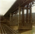
| + | Image:Harvard-Denison_bridge_3.jpg|Concrete supports - east end over the [[Cuyahoga River]] (circa 1964)<br>facing southeast | ||
</gallery> | </gallery> | ||
===Jennings Freeway Demolition=== | ===Jennings Freeway Demolition=== | ||
| - | <gallery> | + | <gallery perrow="5"> |
Image:Freeway4x.jpg|'''West 14th St.''' looking south from Redman. The State shows no mercy for the condemned neighborhood. This view taken in 1964 shows part of the houses already torn down for the Jennings Freeway. | Image:Freeway4x.jpg|'''West 14th St.''' looking south from Redman. The State shows no mercy for the condemned neighborhood. This view taken in 1964 shows part of the houses already torn down for the Jennings Freeway. | ||
Image:West14th-lookingSouth-after.jpg|'''West 14th St.''' looking south from Redman. This view taken in 1964 shows the same area after it was cleaned up a bit. | Image:West14th-lookingSouth-after.jpg|'''West 14th St.''' looking south from Redman. This view taken in 1964 shows the same area after it was cleaned up a bit. | ||
| Line 45: | Line 62: | ||
Image:1302Redman-after.jpg|'''1302 Redman Ave.''' | Image:1302Redman-after.jpg|'''1302 Redman Ave.''' | ||
Image:1314Redman-after.jpg|'''1314 Redman Ave.''' Also a shell of it's former self. | Image:1314Redman-after.jpg|'''1314 Redman Ave.''' Also a shell of it's former self. | ||
| - | Image:Freeway5x.jpg|'''Denison Ave.''' looking east. The vantage point is the East Denison playground sidewalk that led into the open lot on the corner of W.15th and Denison. You are looking out across what used to be Kilroy's house, the bakery, and [[Gasior's Bar]]. All gone now. The building just left of center is [[Slabe's Shoe Store]] with the [[Harvard-Denison Bridge]] just right of that. | + | Image:Freeway5x.jpg|'''Denison Ave.''' looking east. <br><small>The vantage point is the East Denison playground sidewalk that led into the open lot on the corner of W.15th and Denison. You are looking out across what used to be Kilroy's house, the bakery, and [[Gasior's Bar]]. All gone now. The building just left of center is [[Slabe's Shoe Store]] with the [[Harvard-Denison Bridge]] just right of that.<br> '''Point of Interest:''' Streetcar tracks leading towards the playground. Why? <br>'''Answer:''' ''The property behind the school was originally owned by the Cleveland railway System, which became CTS and ultimately RTA. The area now known as the park had two branch lines shown, one running north the other running west into the current park. These served the trolley tracks on Denison Avenue both east and west. Possibly this was an area where they stored spare cars when not needed. Both lines dead end in the park. |
| + | I verified this with city maps which date to 1930’s. So the park was created after that time frame.'' Thanks to Steven Skidd for this information!</small> | ||
</gallery> | </gallery> | ||
| - | === | + | ===Miscellaneous=== |
| + | |||
| + | :Photos wanted! Please submit any you might have for the Brooklyn Centre area to [mailto:barbarowa@yahoo.com barbarowa@yahoo.com] | ||
| - | : | + | <gallery perrow="5"> |
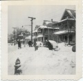
| - | < | + | Image:1950_snowstorm_on_Redman_(01).jpg|Scene on Redman Ave. (or possibly at 3706 W.13th) just after the great 1950 snowstorm. <br><small>(Submitted by Sally Kalemba)</small> |
| - | Image: | + | Image:1950_snowstorm_on_Redman_(02).jpg|Scene on Redman Ave. just after the great 1950 snowstorm. Houses in the foreground are (right to left) 1226, 1230, and 1302 Redman.<br><small>(Submitted by Sally Kalemba)</small> |
| + | Image:1950_snowstorm_on_Redman_(03).jpg|Scene on Redman Ave. just after the great 1950 snowstorm. Houses in the foreground are (right to left) 1226, 1230, and 1302 Redman.<br><small>(Submitted by Sally Kalemba)</small> | ||
</gallery> | </gallery> | ||
| - | ===Miscellaneous=== | ||
| - | : | + | <div style="margin-left:1.0cm;margin-right:1.0cm;font-size:80%;border:1px solid #a3bfb1;text-align:left;color:#000;padding:0.8em 0.8em;">'''SNOWSTORM COMMENTARY''' |
| - | < | + | The above photos give us an idea of the aftermath of the Great Thanksgiving Blizzard of 1950. The storm raged on from Nov. 23rd thru Nov. 27th with howling winds, near zero temperatures, and dropping nearly two feet of snow on Cleveland. You can see from the pictures that the drifts were huge. |
| - | + | ||
| - | </ | + | The 1951 city directory shows who may have lived in the houses shown in the snowstorm picture: |
| + | |||
| + | :1226 Umerley Leo J jr<br> | ||
| + | :1226 Walczesky Edw<br> | ||
| + | |||
| + | :1230 Andreasik Louis J<br> | ||
| + | :1230 Kimall Richd C (this should really be Richard KIMBALL) <br> | ||
| + | |||
| + | :1302 Chmura Bernard S<br> | ||
| + | :1302 Dzierzawski Theo H<br> | ||
| + | |||
| + | One has to assume that the snow shovelers were probably residents of those houses since they were obviously trying to dig out that buried car. | ||
| + | |||
| + | I know nothing about Umerley. | ||
| + | |||
| + | Walczesky was married to a Czarnecki, though I'm not sure if she was related to the Czarnecki's on W.13th street or not. If so, there were plenty of Czarnecki boys to lend a hand. | ||
| + | |||
| + | Andreasik would have been 48 in 1950 and none of the shovelers look that old. Same with Kimball (they misspelled his name in the city directory) -- he was 47. He happened to die just a few months later of a heart attack, so I wonder if he would have even attempted to shovel snow if he knew he had heart problems? | ||
| + | |||
| + | Bernard Chmura was 26 and very likely one of the guys out there. Right age. | ||
| + | |||
| + | I know nothing about Dzierzawski. | ||
| + | |||
| + | So somewhere in the above information is likely the answer. Maybe one day someone from those families will stumble across the pictures and recognize the faces and write to me. We can only hope..... | ||
| + | <p style="text-align:right"> | ||
| + | -- Sandy</p> | ||
| + | </div> | ||
| + | |||
| + | |||
| + | '''Tornado - June 8, 1953''' | ||
| + | |||
| + | :Does anyone have any neighborhood pictures showing some of the damage? Our area didn't get hit nearly as badly as West Park, but the winds were bad enough to bring down some good size trees. | ||
| + | |||
| + | :My recollection is that I was sitting on my Grandmother's porch on [[Redman Avenue]] reading a book when it started getting awfully scary looking outside. The sky seemed to take on a greenish hue. My Grandmother must have been listening to the radio because she rushed to the door and told me to get inside right away. My Mom was working at Republic Steel at the time, so she had no idea if we were safe, or not. Later she told me that the huge steel doors on the shop were shaking and flexing so much that everyone wondered if they'd be ripped off. When all was said and done, our yard had trees down all over. The next morning, it was a heartwarming sight to see all the neighbors going from yard to yard helping clean up the mess. | ||
| + | |||
| + | |||
| + | ===West 25th St.=== | ||
| + | |||
| + | :To see photos of the W.25th St. area, see the [[Ruth Ketteringham Collection]] which includes very early photographs from the late 1800's up thru about 1987. | ||
| + | |||
| + | |||
| + | ===Submit Your Photographs=== | ||
| + | |||
| + | :Photos wanted! Please submit any you might have for the Brooklyn Centre area to [mailto:barbarowa@yahoo.com barbarowa@yahoo.com] | ||
| + | |||
| + | |||
| + | |||
| + | <center> | ||
| + | {{back2albums}} | ||
| + | </center> | ||
Current revision
Contents |
West 13th, West 14th, West 15th, and Redman
West 14th St. and Denison looking north |
||||
West 14th St. looking south from Redman Ave. towards Denison Ave. (Before the Jennings Freeway.) |
West 14th St. looking south from Redman Ave. towards Denison Ave. (Before the Jennings Freeway.) |
City Dump and Redman Woods
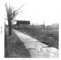
City Dump - Facing north (just north of Denison Ave. and west of West 15th) The rubbish that was dumped here served as a landfill. Originally, there was a deep ravine between Riverside Cemetery and the property on West 15th Street |
Redman Woods - Facing east. The woods were between Jennings Ave. and Redman Ave. and belonged to Riverside Cemetery |
Redman Woods - Facing south. The woods were between Jennings Ave. and Redman Ave. and belonged to Riverside Cemetery |
Redman Woods - Mystery wall. This odd stone wall was on the northern part of the Redman woods. We never have been able to figure out why. Riverside Cemetery was probably planning to span the ravine with a bridge to allow vehicle traffic from one side to the other. |
Denison Ave., Jennings Ave.
Denison Ave. and West 14th looking west. |
||||
Factories in the Jennings and Denison Aves. area. The tall smoke stacks are probably part of Harshaw Chemical. |
Harvard-Denison Bridge
Concrete supports - east end over the Cuyahoga River (circa 1964) |
Jennings Freeway Demolition
Denison Ave. looking east. |
Miscellaneous
- Photos wanted! Please submit any you might have for the Brooklyn Centre area to barbarowa@yahoo.com
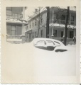
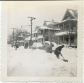
The above photos give us an idea of the aftermath of the Great Thanksgiving Blizzard of 1950. The storm raged on from Nov. 23rd thru Nov. 27th with howling winds, near zero temperatures, and dropping nearly two feet of snow on Cleveland. You can see from the pictures that the drifts were huge.
The 1951 city directory shows who may have lived in the houses shown in the snowstorm picture:
- 1226 Umerley Leo J jr
- 1226 Walczesky Edw
- 1230 Andreasik Louis J
- 1230 Kimall Richd C (this should really be Richard KIMBALL)
- 1302 Chmura Bernard S
- 1302 Dzierzawski Theo H
One has to assume that the snow shovelers were probably residents of those houses since they were obviously trying to dig out that buried car.
I know nothing about Umerley.
Walczesky was married to a Czarnecki, though I'm not sure if she was related to the Czarnecki's on W.13th street or not. If so, there were plenty of Czarnecki boys to lend a hand.
Andreasik would have been 48 in 1950 and none of the shovelers look that old. Same with Kimball (they misspelled his name in the city directory) -- he was 47. He happened to die just a few months later of a heart attack, so I wonder if he would have even attempted to shovel snow if he knew he had heart problems?
Bernard Chmura was 26 and very likely one of the guys out there. Right age.
I know nothing about Dzierzawski.
So somewhere in the above information is likely the answer. Maybe one day someone from those families will stumble across the pictures and recognize the faces and write to me. We can only hope.....
-- Sandy
Tornado - June 8, 1953
- Does anyone have any neighborhood pictures showing some of the damage? Our area didn't get hit nearly as badly as West Park, but the winds were bad enough to bring down some good size trees.
- My recollection is that I was sitting on my Grandmother's porch on Redman Avenue reading a book when it started getting awfully scary looking outside. The sky seemed to take on a greenish hue. My Grandmother must have been listening to the radio because she rushed to the door and told me to get inside right away. My Mom was working at Republic Steel at the time, so she had no idea if we were safe, or not. Later she told me that the huge steel doors on the shop were shaking and flexing so much that everyone wondered if they'd be ripped off. When all was said and done, our yard had trees down all over. The next morning, it was a heartwarming sight to see all the neighbors going from yard to yard helping clean up the mess.
West 25th St.
- To see photos of the W.25th St. area, see the Ruth Ketteringham Collection which includes very early photographs from the late 1800's up thru about 1987.
Submit Your Photographs
- Photos wanted! Please submit any you might have for the Brooklyn Centre area to barbarowa@yahoo.com
Return to Photo Albums or
Help support this website by visiting some of the Ads provided by Google.


